Geospatial Foundation Models and Embeddings
Geospatial embeddings for satellite imagery are gaining more traction nowadays, for instance with the launch of Google DeepMind's AlphaEarth and the TESSERA embeddings. It’s fantastic to see this field rapidly evolve and getting the Earth observation community motivated to explore.
However, geo-embeddings have been at the core of ESA's WorldCereal project for more than two years. Back then, the concept of embeddings was not very well-known yet. The backbone of the WorldCereal system is NASA Harvest's Presto geospatial foundation model. This pioneer model is continuously fine-tuned on the ever-growing WorldCereal global reference database (containing global land cover and crop type labels) and powers the system's crop-mapping workflows. The insights from this geospatial data empowers users around the world to better understand agricultural landscapes.
WorldCereal Workflow and Integration
WorldCereal now also provides a workflow for users to generate and access these underlying embeddings directly. This means you can explore these geospatial embeddings yourself and build on top of them for custom applications. Want to try it out? Check out the instructions in the WorldCereal Embeddings Demo Notebook.
As geospatial foundation models are evolving rapidly, the WorldCereal team has built their open-source system in such way that you can integrate other models in the future as well! Interested in how we do this? Take a look at this library we are developing for that purpose.
With these enhancements, WorldCereal wants to enable decision-makers better support agriculture and food security efforts worldwide.
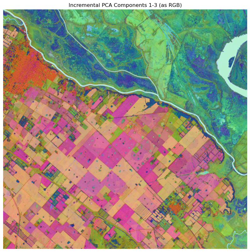
A visual example of dynamically computed Presto embeddings in a region close to Buenos Aires, Argentina. The Presto model used to compute these embeddings was finetuned on land cover based on all data currently present in WorldCereal’s Reference Data Module. The 128 embeddings are visualised here based on a PCA-reduced three-component RGB.