View and Download WorldCereal Maps
The WorldCereal project produced the first seasonally updated temporary crops, crop type, and irrigation maps at 10-meter spatial resolution and at global scale. Currently, our product collection contains data for 2021, but more products will be added by the end of 2026.
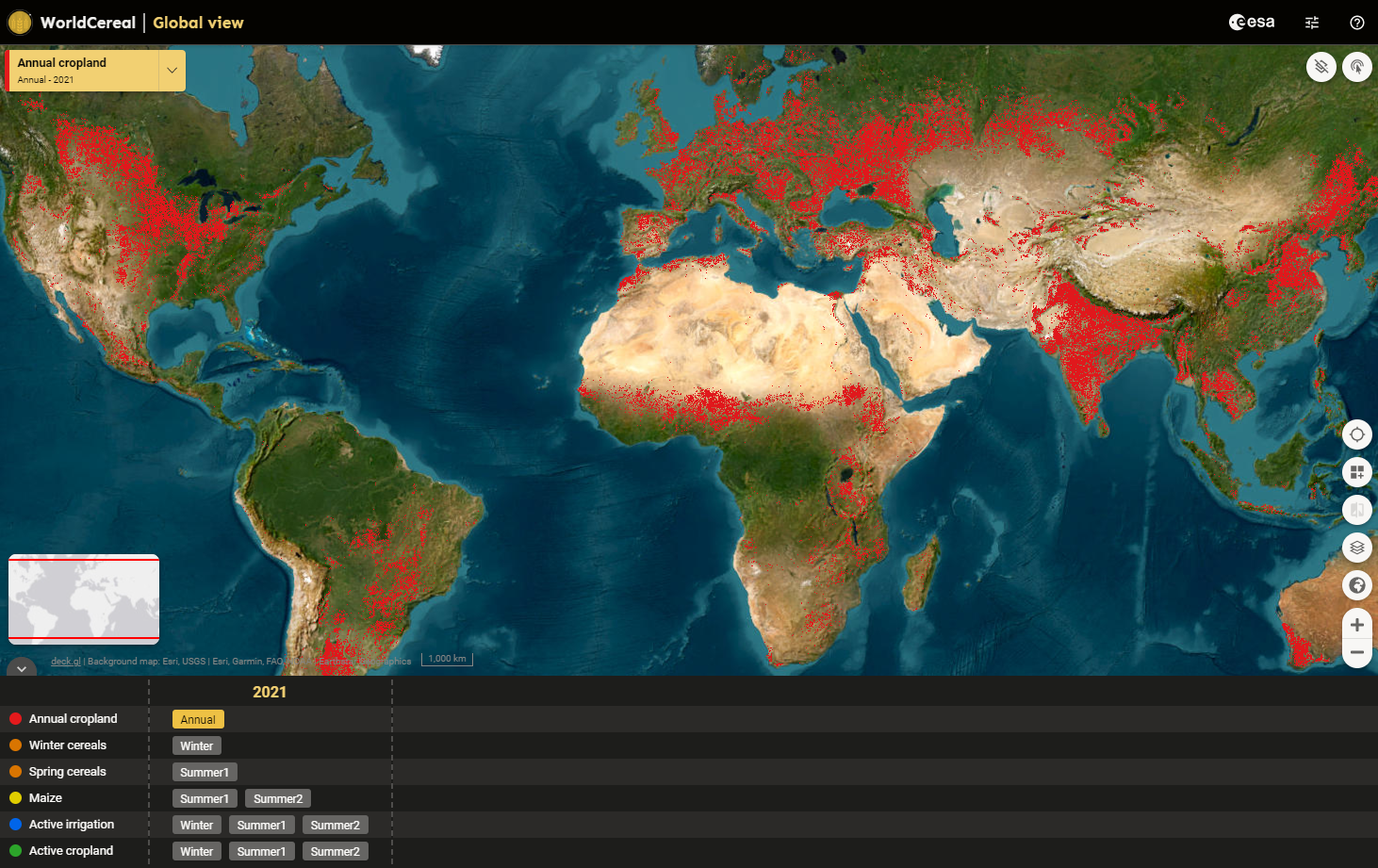
We recommend using the official WorldCereal Interactive Viewer to quickly visualise our global maps and associated statistics. You can find guidance on how to use this application here.
There are also several ways to download the products for integration into your own applications:
- Do you want to download a portion of the map for your area of interest?
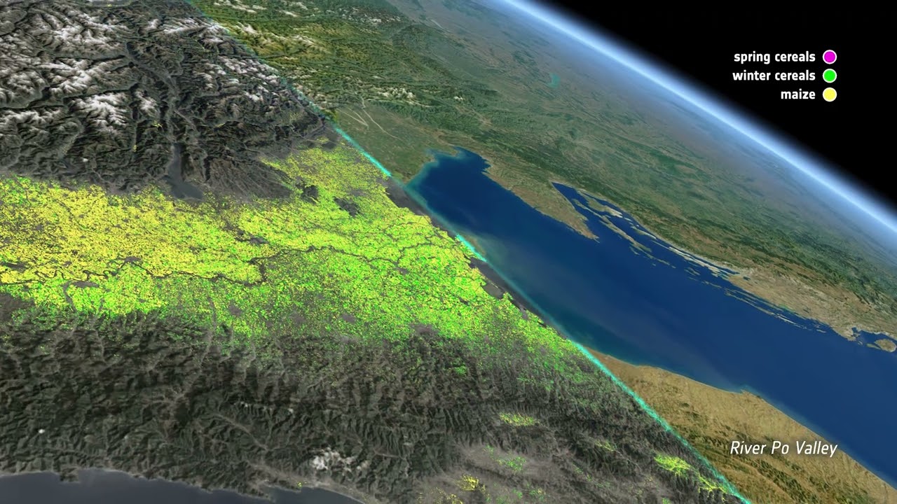
Use our convenient web interface to draw your area and start the download with just a few clicks! Get detailed instructions on Github or in this video. - Or do you want to download the full global products?
Consult our product collection in our Zenodo repository.
Are you working in Google Earth Engine?
Then you can access the 2021 product collection in the Google Earth Engine Data Catalog.
Bear in mind that each global map is comprised of a collection of regional maps, each characterised by its own definition of agricultural seasons. This means in practice that maps from neighbouring zones cannot be readily compared and you should take utmost care when interpreting the global maps as a whole. You can find more information on the WorldCereal seasons and agro-ecological zones (AEZ) here.
In the following sections you can read more about our product definitions.
WorldCereal 2021 product definitions
In WorldCereal, temporary crops have been defined as crops with a less-than-one-year growing cycle which must be newly sown or planted for further production after the harvest (FAO, 2023). Sugar cane, asparagus, and cassava are also considered as temporary crops. The WorldCereal 2021 temporary crop maps exclude perennial crops as well as (temporary) pastures. These maps are generated once a year.
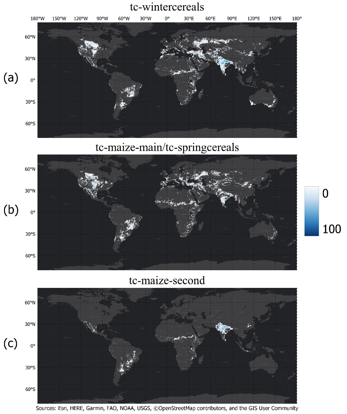
Next to this annual product, WorldCereal provides several season-specific products including maize, winter cereals, spring cereals, active cropland and active irrigation. Seasonal products are always generated at the end of a growing season. Check out the table below to learn more about which products are generated in the different seasons. Seasonal products are always masked with the annual temporary crop extent product, meaning that only pixels identified as temporary crops will be classified by these algorithms.
The WorldCereal crop type products provide binary maps for the maize and wheat growing seasons showing where maize and cereals are grown. Cereals include wheat, barley and rye, which belong to the Triticeae tribe. These crops were grouped together because their spectral signatures and growing seasons were too similar to reliably distinguish them at a global scale.
The WorldCereal active cropland product indicates whether a pixel identified as temporary crops has been actively cultivated during a specific growing season. For a pixel to be labeled as “active”, a full crop growth cycle (sowing, growing, senescence and harvesting) needs to take place within the designated time period. Note that this active marker is not crop-type specific and will capture other crop types aside from cereals and maize as long as they show a similar growing season. This also means in practice that any crop grown (slightly) outside the predefined growing seasons will not be flagged as active cropland in any of the seasons covered by the system.
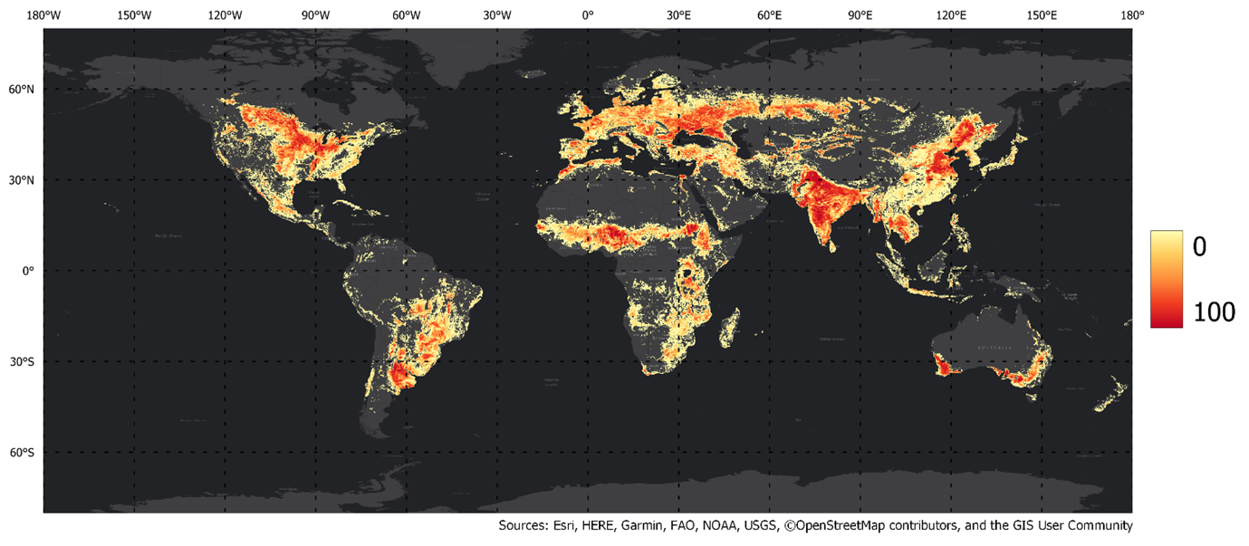
Seasonally actively irrigated cropland is defined by the WorldCereal system as a piece of land that is extensively irrigated during a specific growing season where, without irrigation applied at regular intervals, crop growth would be significantly reduced or impossible. Incidental irrigation, such as irrigation that has been applied only during the sowing period of a crop, is not translated to actively irrigated cropland.
WorldCereal seasons and associated products
| Season | Product | Remarks |
|---|---|---|
| tc-annual | Temporary crops maps | Defined based on the last season within the target year |
| tc-wintercereals |
Winter cereals map |
Main cereals season |
| tc-maize-main / tc-springcereals |
Maize map Spring cereals map Active cropland map Active irrigation map |
Only mapped in parts of Northern hemisphere |
| tc-maize-second | Maize map Active cropland map Active irrigation map |
Available only in tropical regions |
WorldCereal 2021 annual temporary crop extent product
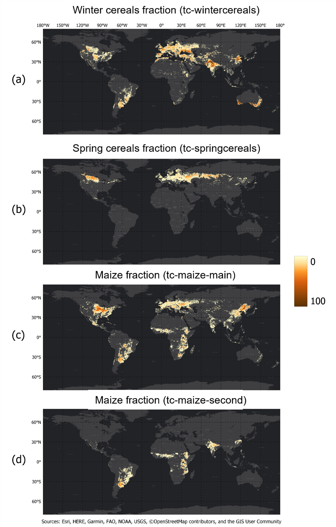
WorldCereal 2021 seasonal crop type maps
WorldCereal 2021 seasonal irrigation maps