WorldCereal system v1
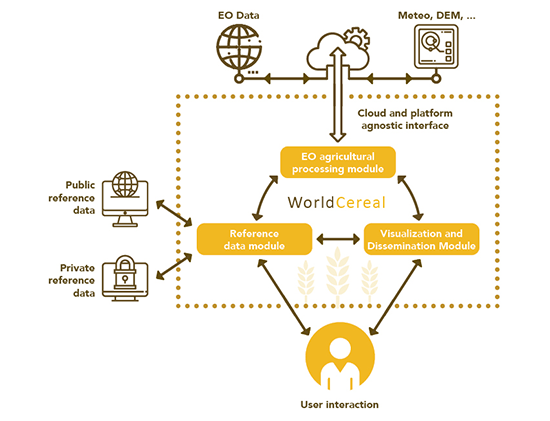
In line with the objectives and requirements listed above, a first WorldCereal system has been designed and implemented on both CreoDIAS and AWS. The WorldCereal system is comprised of three different modules:
- The Reference Data Module (RDM): this module acts as a repository for all collected and harmonized in-situ reference data, along with standardized metadata. The necessary functionality has been added that allow users to query the contents of the repository and also contribute new datasets to it. For the latter aspect, the necessary comprehensive guidelines are supplied to the user. More information on the Reference Data Module and how to access and contribute, can be found on this dedicated page.
- The Classification Module (CM): this module combines all functionality required to train and apply dedicated cropland, crop type and irrigation models, starting from pre-processed EO time series and in-situ reference data. The entire code base is publicly available and can be consulted on github.
Please note that the WorldCereal system v1 was mainly intended to demonstrate the feasibility of global and season-specific cropland mapping. As part of WorldCereal Phase II, the classification system is now being transformed into a more operational and user-friendly cloud-based service.
- The Visualization and Dissemination Module (VDM): this graphical user interface has been built to visualize the global WorldCereal products. Aside from the option to view the products in their entirety at global level, the viewer also features a more detailed seasonal exploration tool allowing to inspect individual AEZ-based products, as such fully accounting for the complex nature of the seasonal WorldCereal products. Finally, the module also contains some basic functionality to compute statistics based on the different products.

Global crop calendars and agro-ecological zones (AEZ)
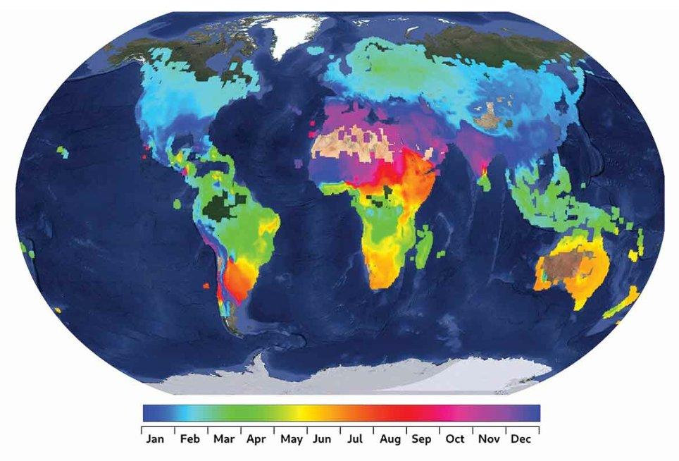
One of the main requirements of WorldCereal is to dynamically map global agriculture. In contrast to other products that give an estimation of the agricultural land per year or averaged over three years, WorldCereal maps global agriculture on a seasonal basis. But how to define these seasons and which seasons do we take into account?
Building on work performed by FAO, JRC, GEOGLAM-crop monitor, the WorldCereal team has created global crop calendars for wheat and maize, the two target crops during WorldCereal Phase I, to define start and end of the different growing seasons.
Discover here more details on how these calendars were created and used to define unique agro-ecological zones (AEZ), which in turn form the basis for generating the WorldCereal products.

Robust classification models
During the first two years of the WorldCereal project, the team focused intensively on benchmarking different classification algorithms and approaches to learn how this global mapping challenge could be accomplished with spatially scattered training data. Some first lessons learned are summarized in this blog post. In the end, the team adopted an array of binary pixel-based CatBoost classification models, trained at continental (temporary crops) or global (crop type, irrigation) level. More details on which EO data sources, derived features and ancillary data were used to train these models can be consulted in our methodological paper.
First set of global maps for 2021
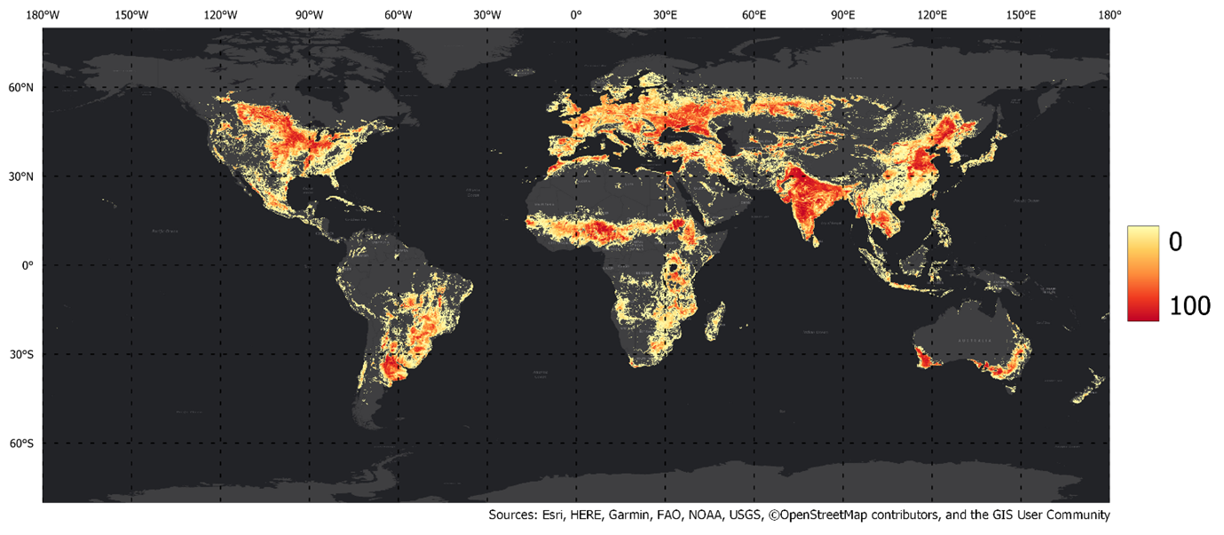
Less than three years after the official kick off, the WorldCereal team was proud to release the world’s first dynamic set of seasonally-updated temporary crops, crop type and irrigation maps at 10-meter spatial resolution and global scale. A spatially resampled version of the temporary crop extent map is shown in the figure below.
More information on the products themselves and the different ways to access our publicly available maps can be found on this page.
WorldCereal 2021 temporary crop extent map

